virtual_competition:documentation
−Table of Contents
Create virtual balloon flight

Main Page: Virtual Balloon Distance Race
Create documentation
How to create the data files to participate in the virtual gas balloon long distance competition.
Launch point
Koordinates of the launch point:
48.69311 N 6.183333 E Place Stanislas1) in Nancy (FRANCE)
Calculate Trajectory
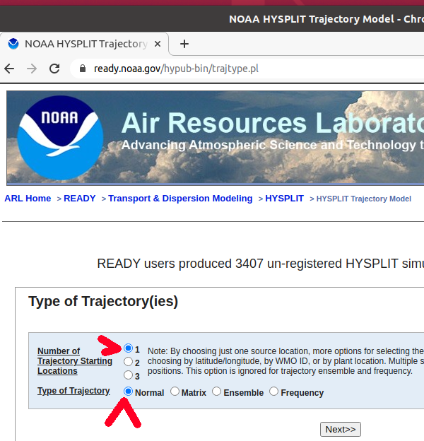
1
!If you have difficulties to reach the server, try another browser.
Select HYSPLIT-WEB (Internet-based) –> Run HYSPLIT TRAJECTORY MODEL

2

3
- Number of Trajectory Starting Locations: Select »1«
- Type of Trajectory: Select »Normal«
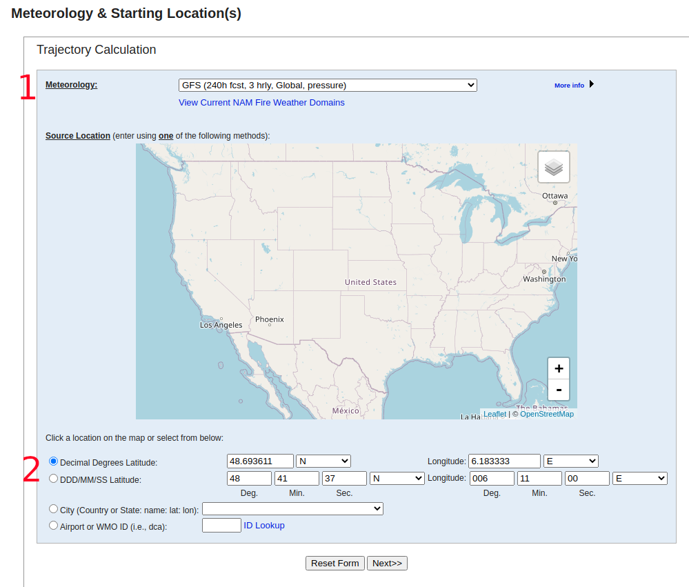
4 Meterology and Starting Location
- Meteorology: Select »GFS (240h fcst, 3 hrly, Global, pressure)
- Fill in the coordinates of the starting location.
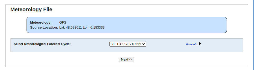
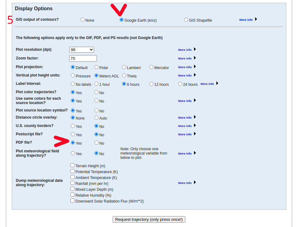
5 Meteorology File
You can overtake the proposal.
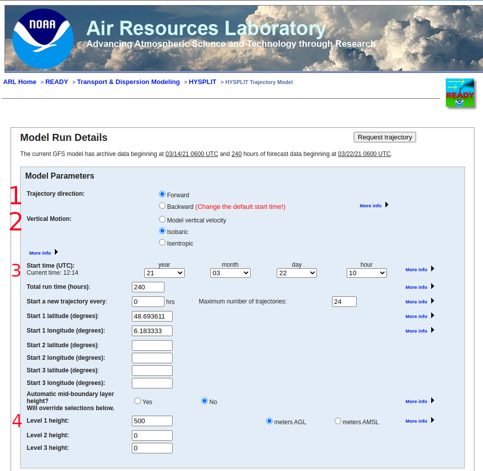
6 Model run details
- Trajectory direction: Select »Forward«
- Vertical Motion: Select »Isobaric«
- Start time (UTC): Choose your time of the planned launch.
- Choose your flight level. Normally you can choose up to three, but for the competition file choose only one please.
- Display Options: Select Google Earth (kmz) and PDF file? Yes
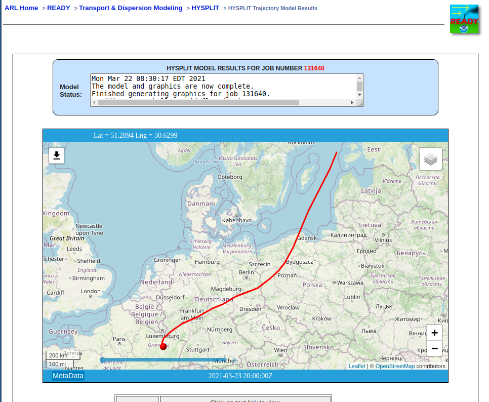
7
Download PDF and KMZ
- Download PDF PLots ».pdf«
- Download Google Earth ».kmz«

Endurance
Select until when the altitude is to be maintained.
Coordinates for new calculation
- Open »Trajectory endpoints file«.
- Select the data and time you want to change altitude.
- Copy the coordinates of the point
- Submit the coordinates and the start time to a new calculation.
- If you use »Return to main menu (keep user inputs)«, you have only to change coordinates, time and altitude.

2nd altitude
3rd altitude
You can merge up to 8 sections of the flight with gpsvisualizer. But we propose to start with maximum 3 sections.
Compose file for competition flight
To merge the files use https://www.gpsvisualizer.com
Select »Google Earth« : https://www.gpsvisualizer.com/map_input?form=googleearth
- Upload your files. Used in this example: HYSPLITtraj_131640.kmzHYSPLITtraj_132070.kmzHYSPLITtraj_132245.kmz.
- Select .kmz for Google Earth.
- Set the other values as shown in the example.

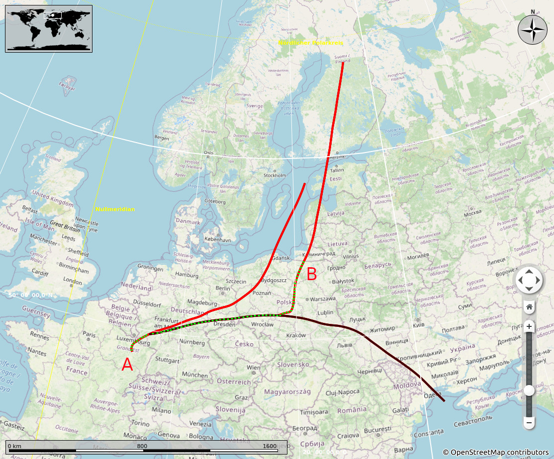
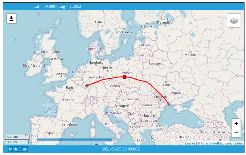
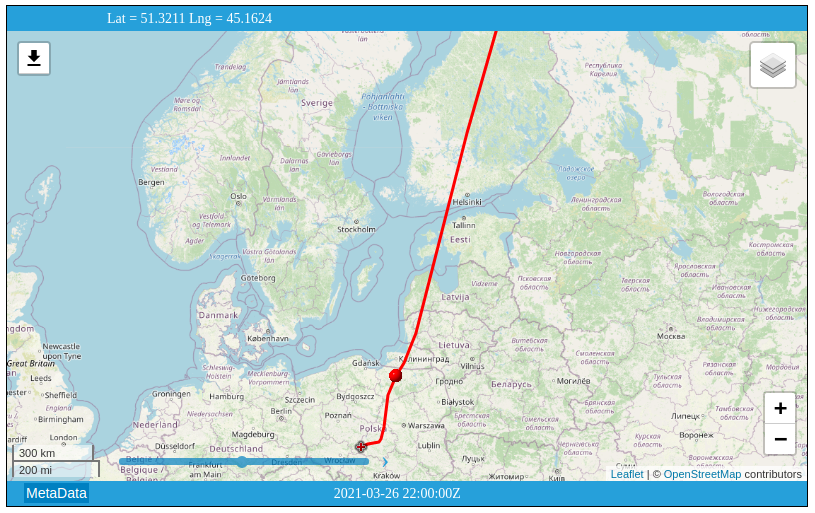
The chart has been created with the KML-file. Due to copyright questions we have not published a screenshot of the Google Earth. To calculate the distance we will mesure between the launch point A and the final point B conform to the rules. In this case, between SR and SS, not over water, and within the competition area. Kaliningrad is outside the competition area, so the final point will be south of the border of Kaliningrad and it is the last point before sunset.
virtual_competition/documentation.txt · Last modified: 2021/03/23 06:41 by Volker Löschhorn