−Table of Contents
Virtual Balloon Distance Race
If you are young and want to develop the project with us, meet us at DINA.international

First idea of the rules
- Competition aera: Member States of the EASA: EASA Member States.
- Flights outside the competition area are permitted, but only measuring points within the competition area will be scored for the end of the flight.
- Maximum duration: 80 hours
- Trajectories must not start higher than 5500m.
- Different part of the flight: 3 (part means a new calculation with a new altitude.
- Trajectories must be submitted by the 2nd midnight (UTC) following the start for the first part, by the 3rd midnight (UTC) following the start for the second part, and by the 4th midnight (UTC) following the start for the third part.
- End of flight measurement points only count between sunrise and sunset.
- Only teams can take part. A team consists of more than one person.
- The virtual race is supervised by the members of the Virtual Balloon Distance Race project within the group Ballaeron - Ballooning Youth Exchange International.
- The files of the trajectories should be sent to the following e-mail address: TBA
Howto
Related projects
Blog
2021/04/06 Trajectories flown by balloons in real life
Here are a few examples of balloon flights that really took place.
Gordon-Bennett-Race 2006 Waasmunster

From Marl to Romania Easter 2007
Three teams flew from Marl in Germany to Romania. The highlight was the crossing of the Carpathian Mountains.
- HB-QHJ Kurt Frieden / Stefan Zeberli
- D-OWNT Dominik Haggeney / Christoph Almodt
- D-OWBA Tomas Hora / Volker Löschhorn
Gordon-Bennett-Race 2008 Albuquerque
Flight of the team Tomas Hora and Volker Löschhorn from Albuquerque to Missouri.
Gordon-Bennett-Race 2009 Geneva
Flight of the Team Tomas Hora and Volker Löschhorn from Geneva to Menorca.
Stuttgart-Bacau September 2011
Flight of the team Tomas Hora / Volker Löschhorn from Stuttgart (Germany) to Bacău (Romania).
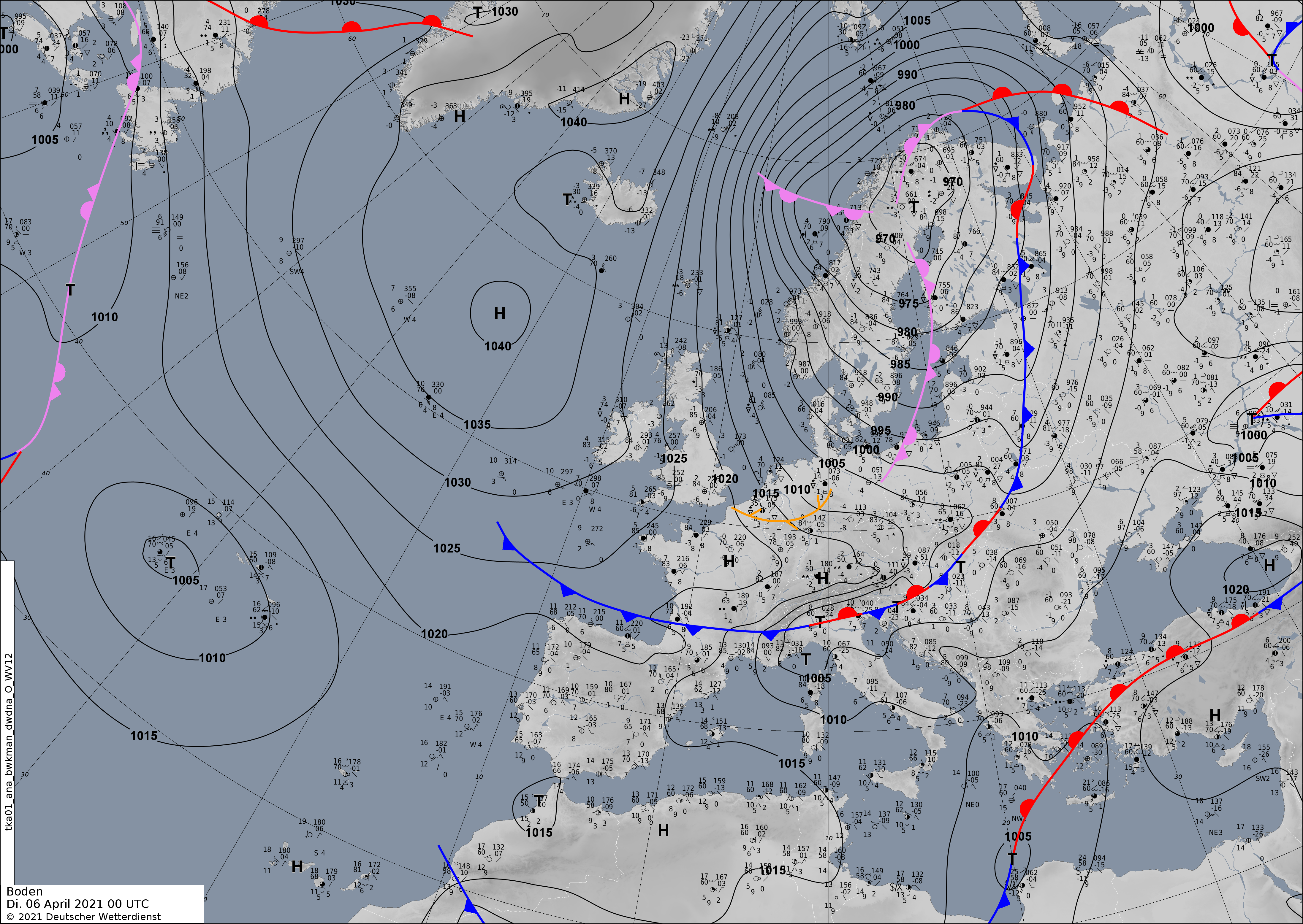
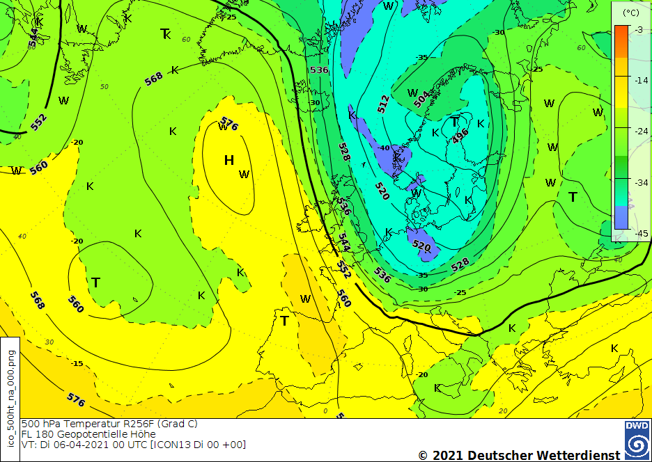
2021/04/06
Analyse Charts
Ground
500hPa
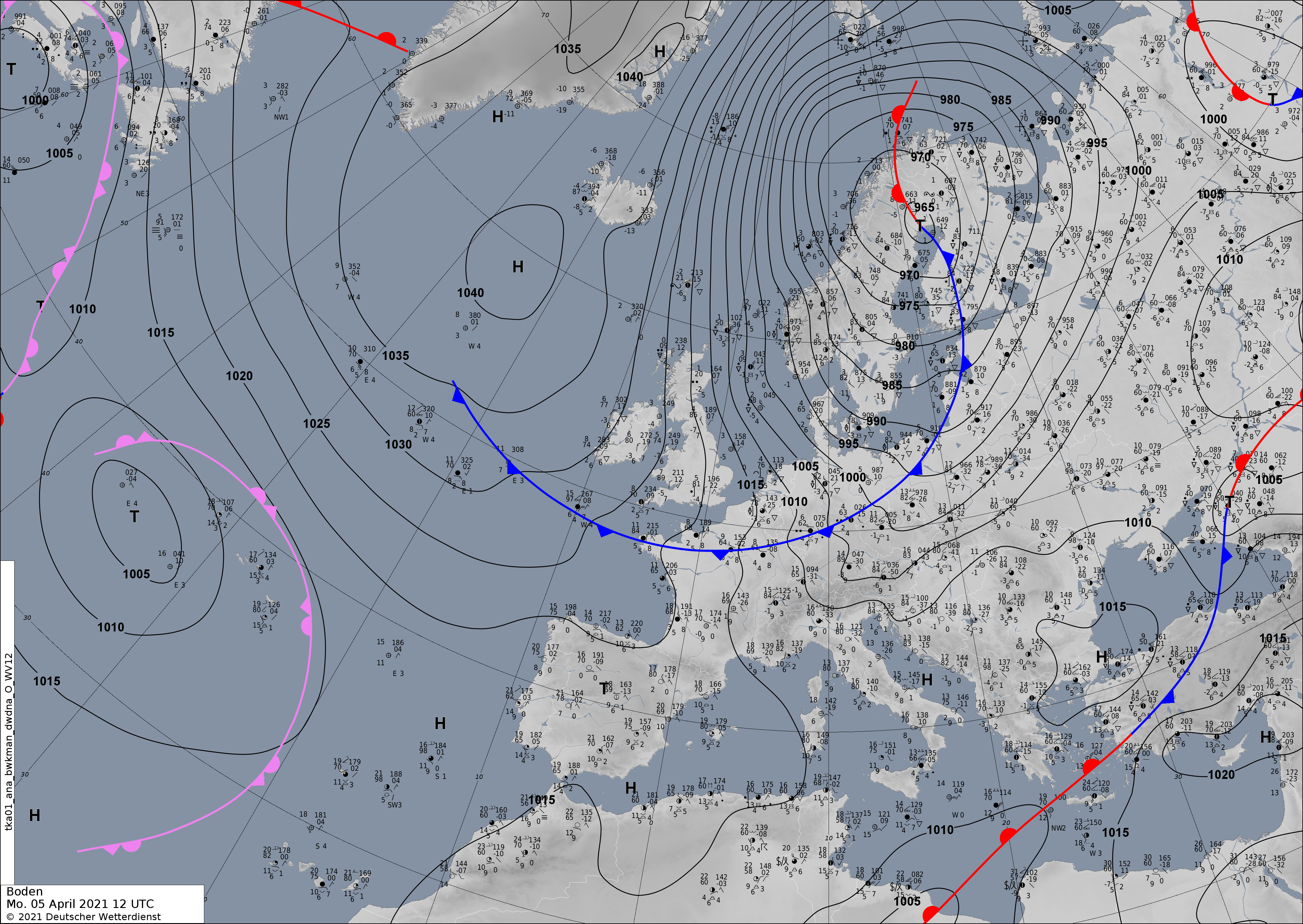
2021/04/05 1700 UTC
Bitterfeld
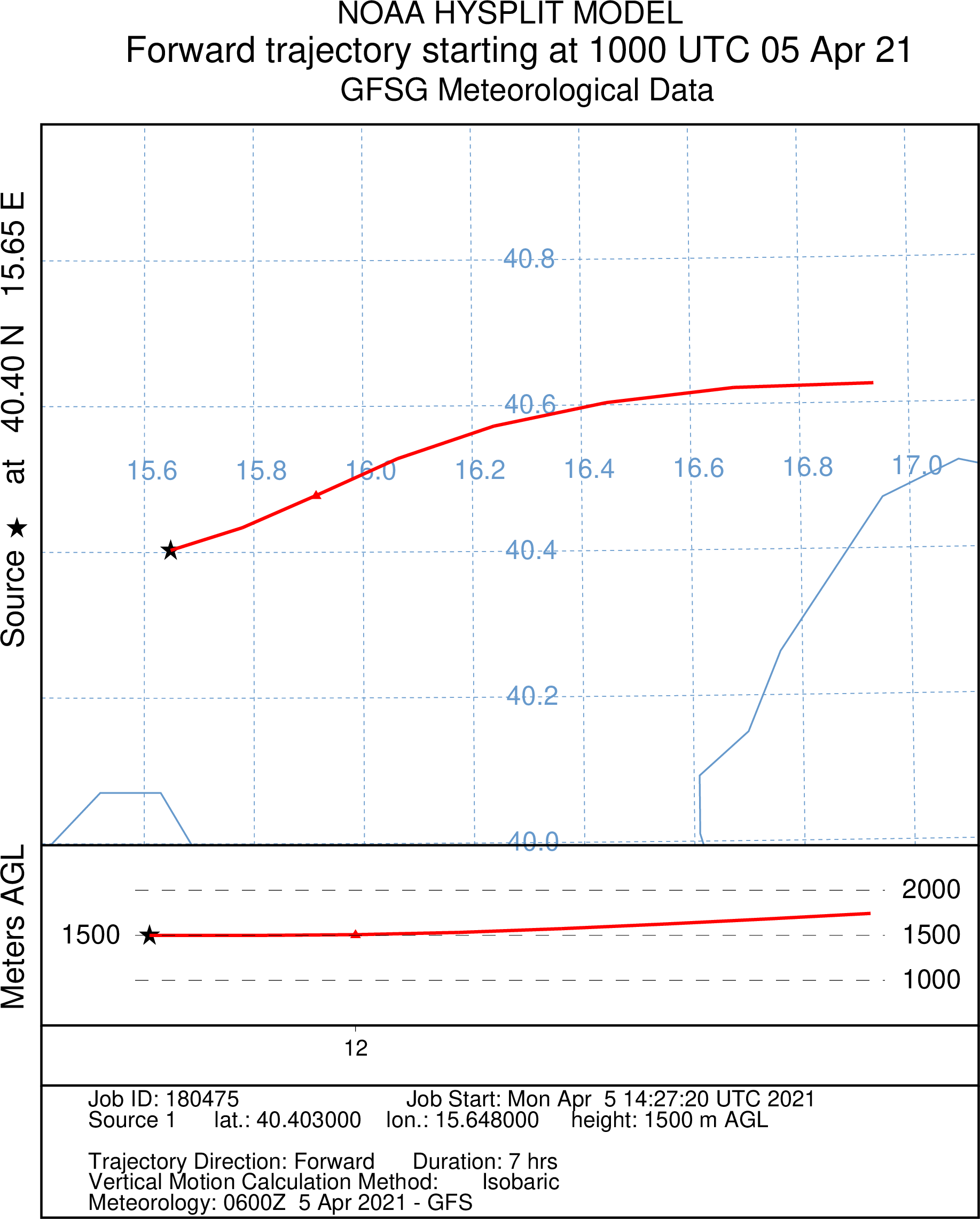
B05
New altitude at 1000 UTC 40.4030 N / 15.6480 E:
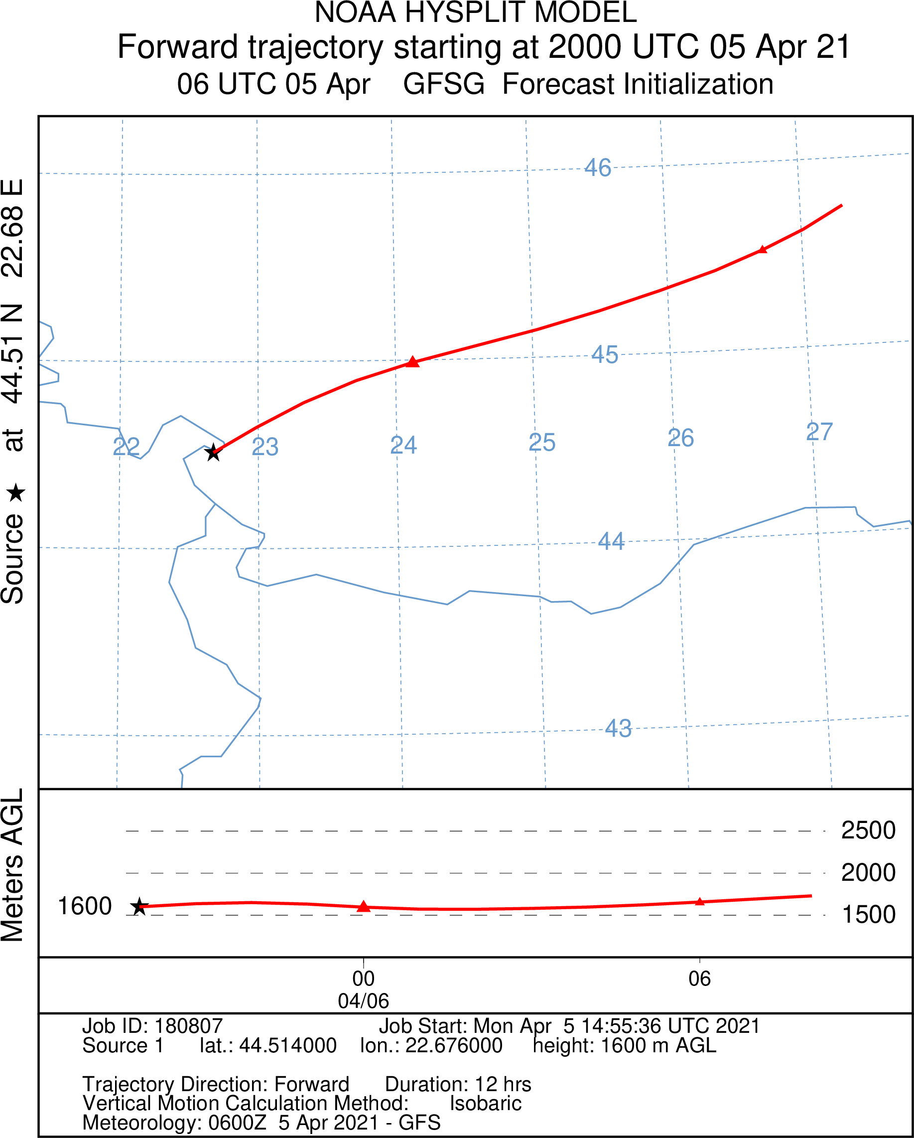
B15
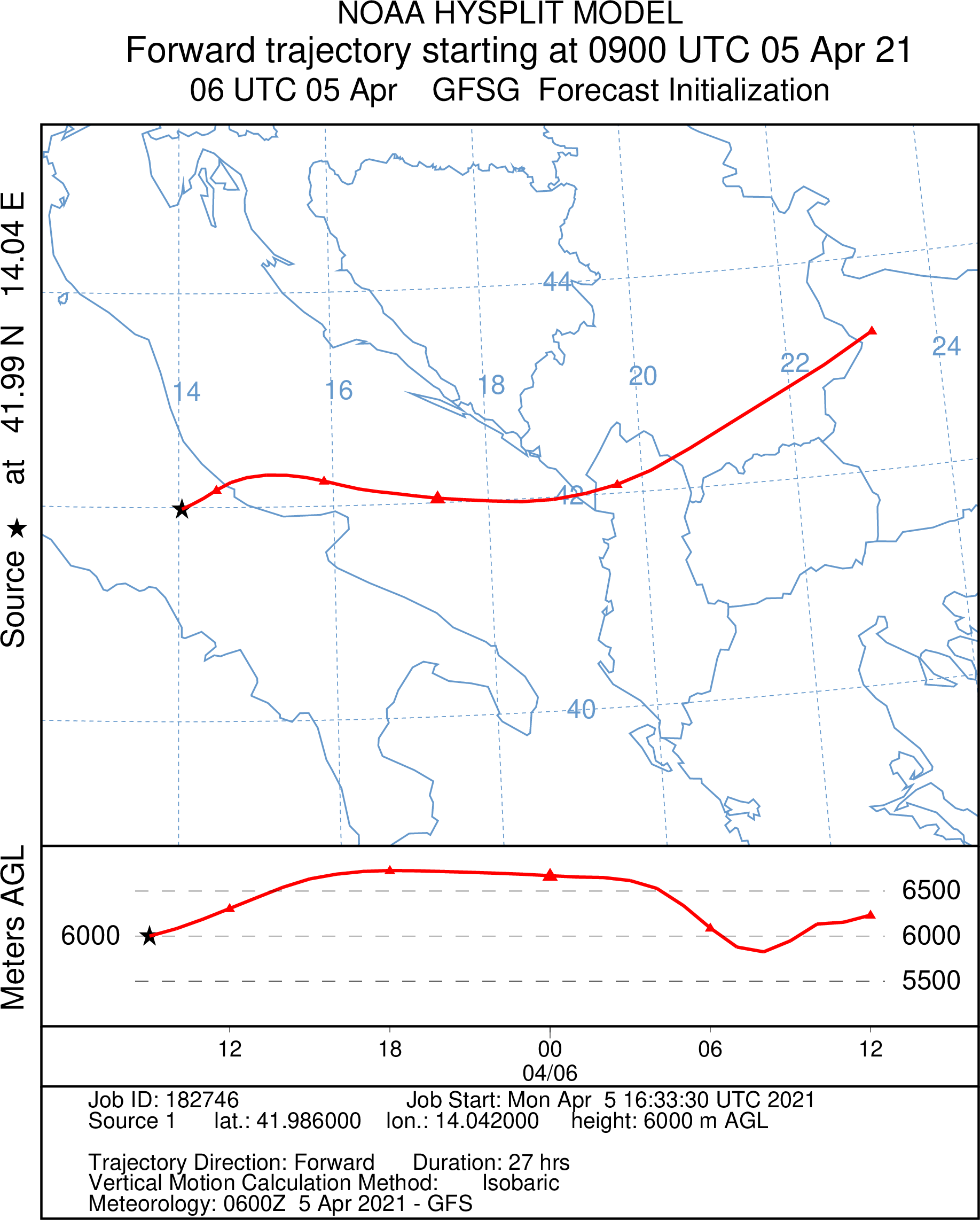
New altitude at 2000 UTC 44.5140 N / 22.6760 E:
B25
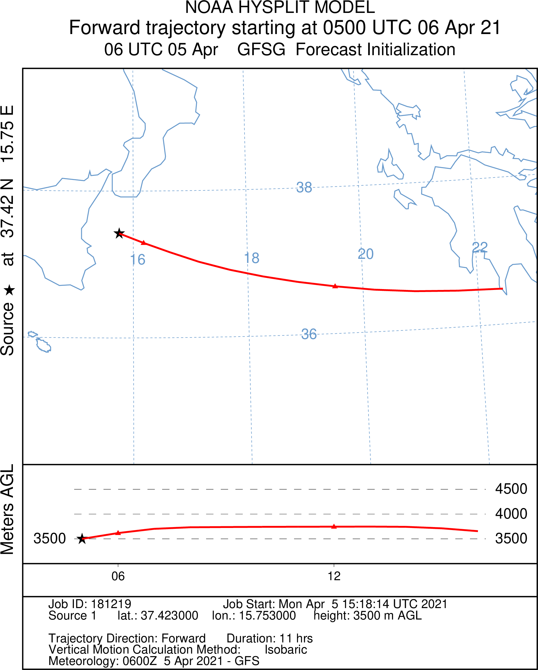
New altitude at 0500 UTC 37.4230 N 15.7530 E:
Nancy
NO5

N15

N25
Wrocław
W05
W15
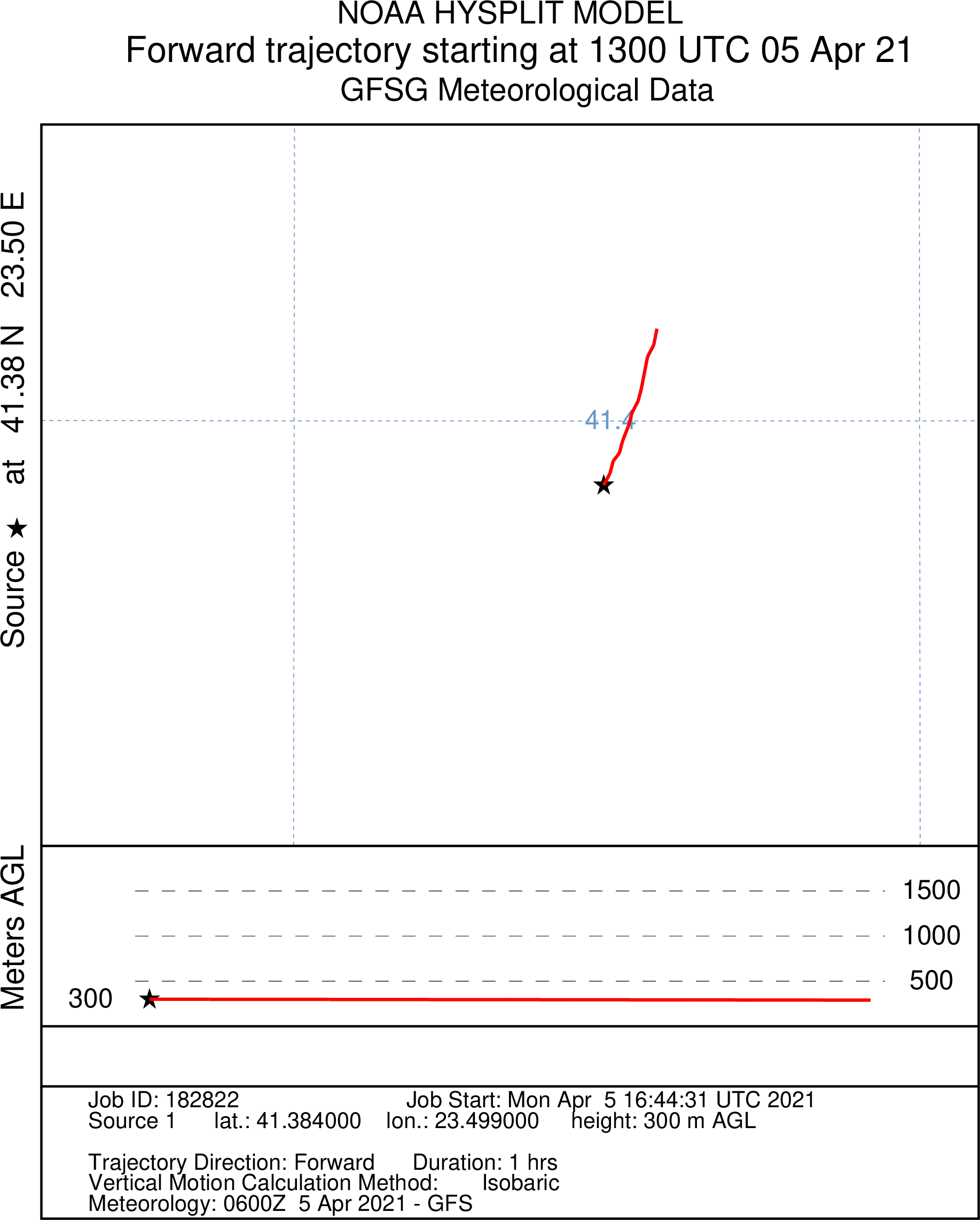
New altitude at 1300 UTC 41.3840 N 23.4990 E:
W25
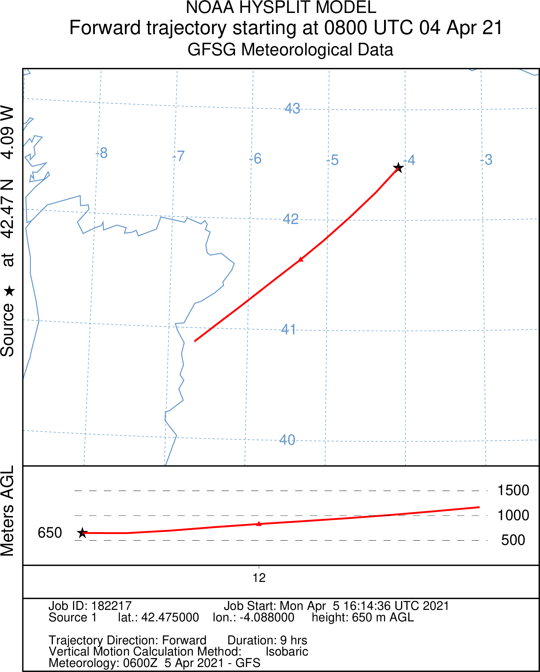
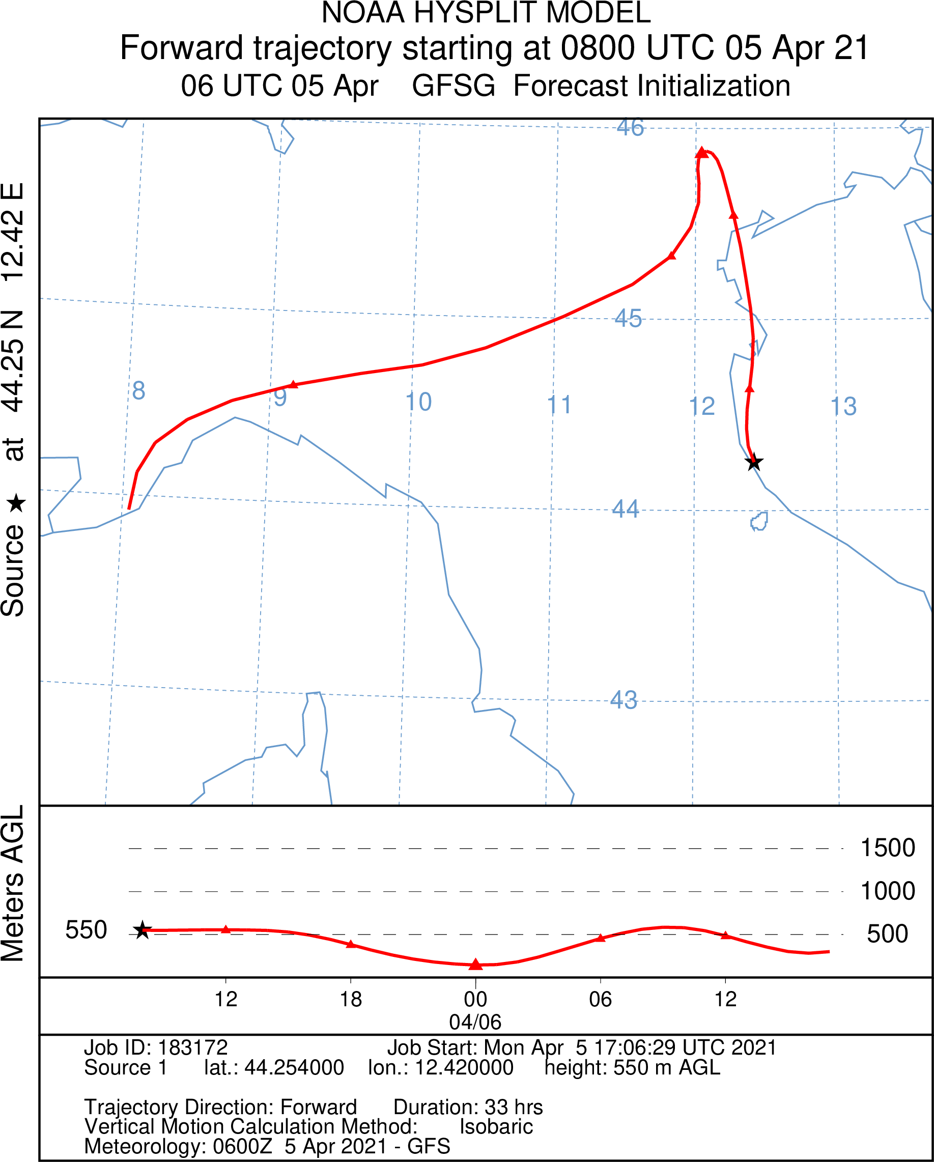
New altitude at 0800 UTC 44.2540 N / 12.4200 E:
2021/04/05 1400 UTC
Last Analyse Chart
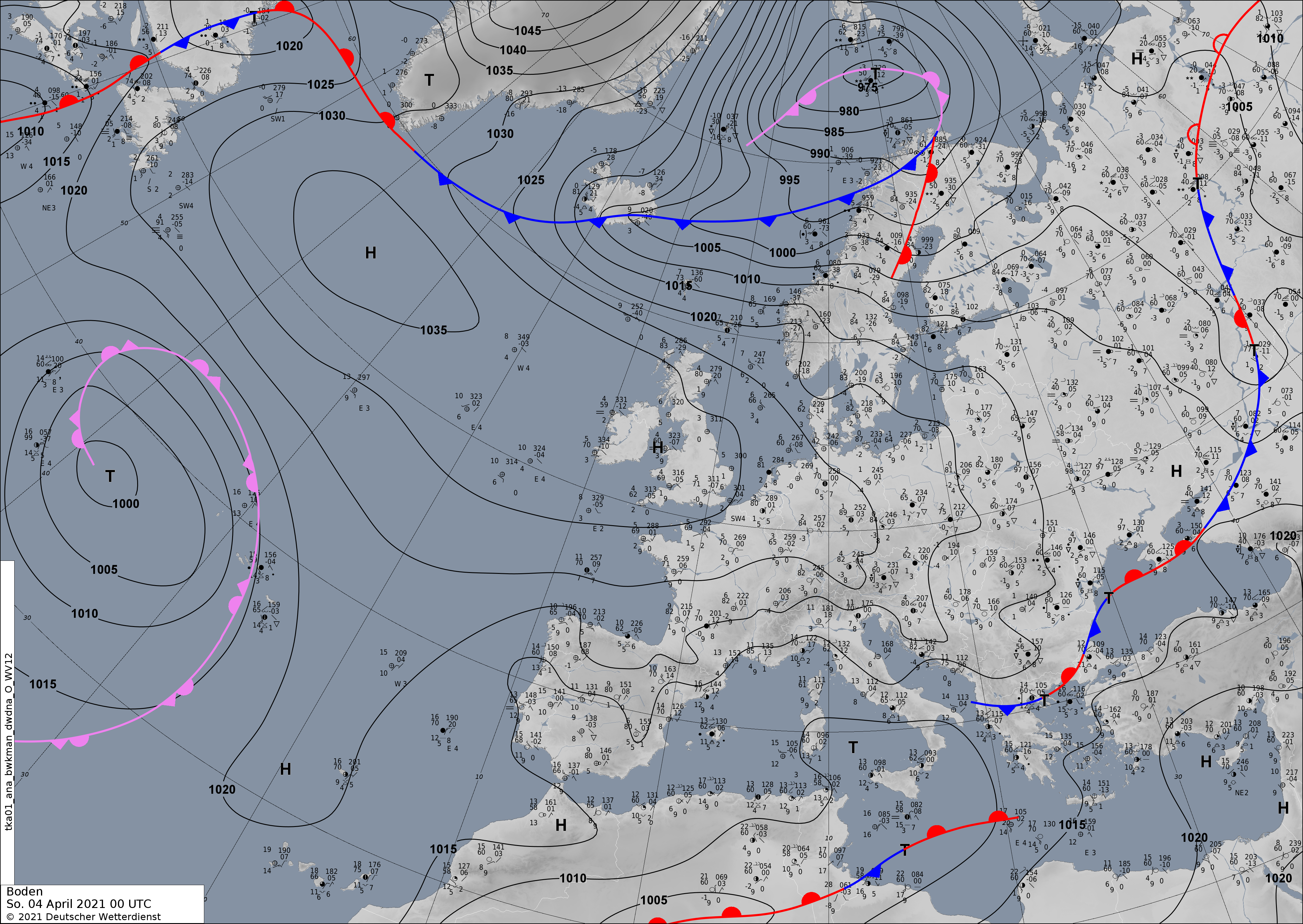
Ground
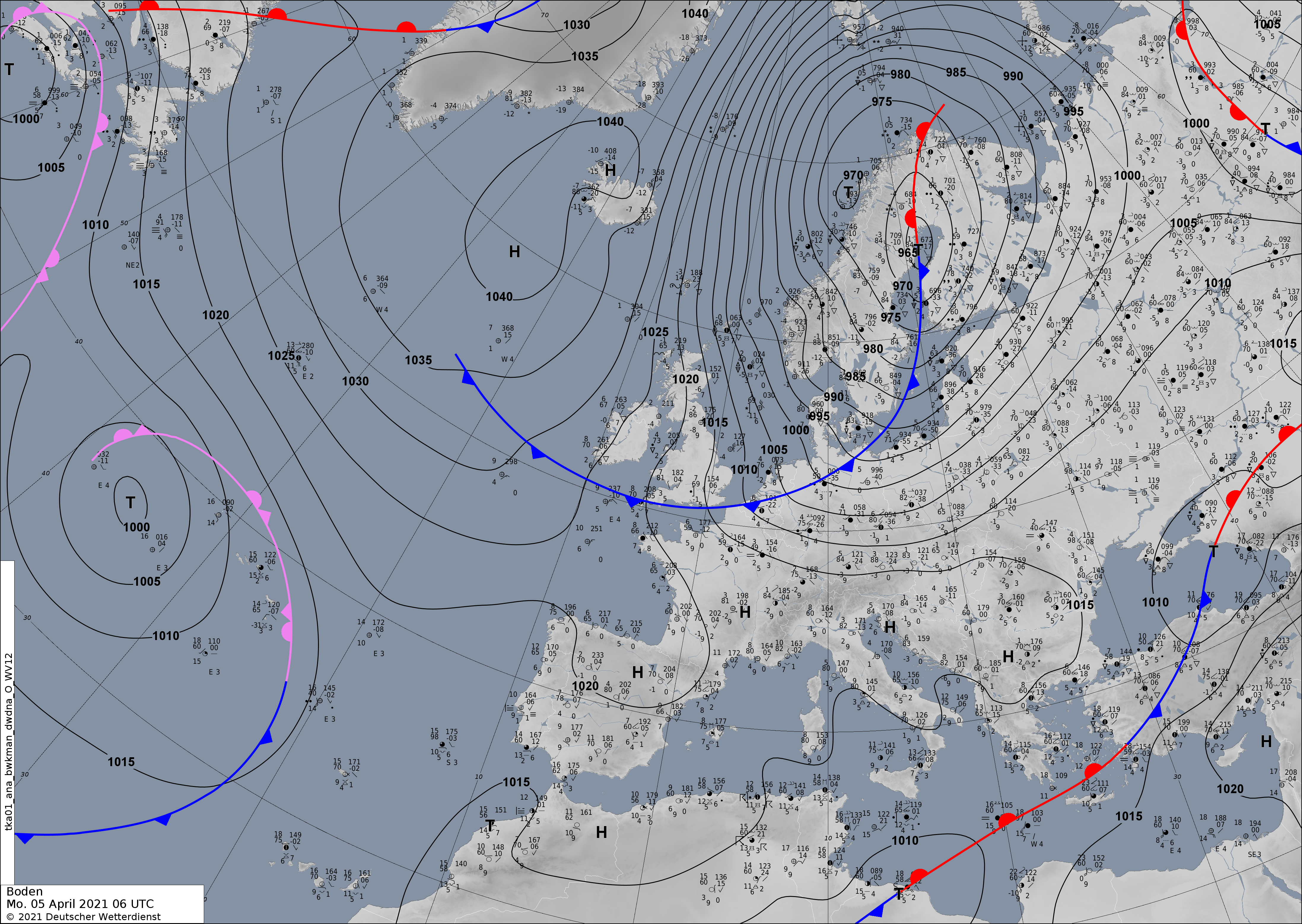
2021/04/05 1000 UTC
Last Analyse Chart
Ground
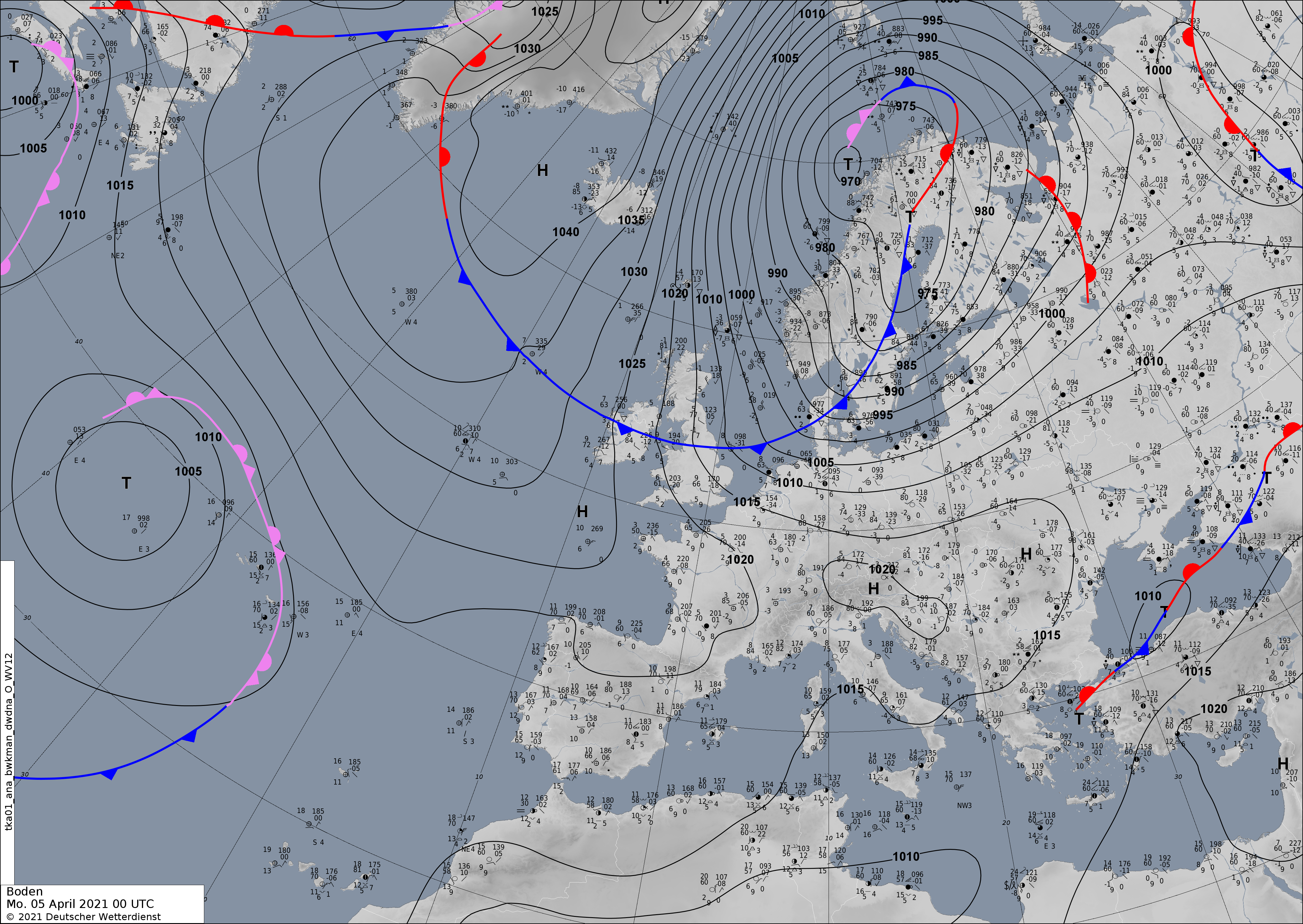
2021/04/05 0200 UTC
Last Analyse Chart
Ground
500hPa

2021/04/04 1200UTC
Bitterfeld
B05
New altitude at 1800 UTC 50.6440 N / 12.4180 E

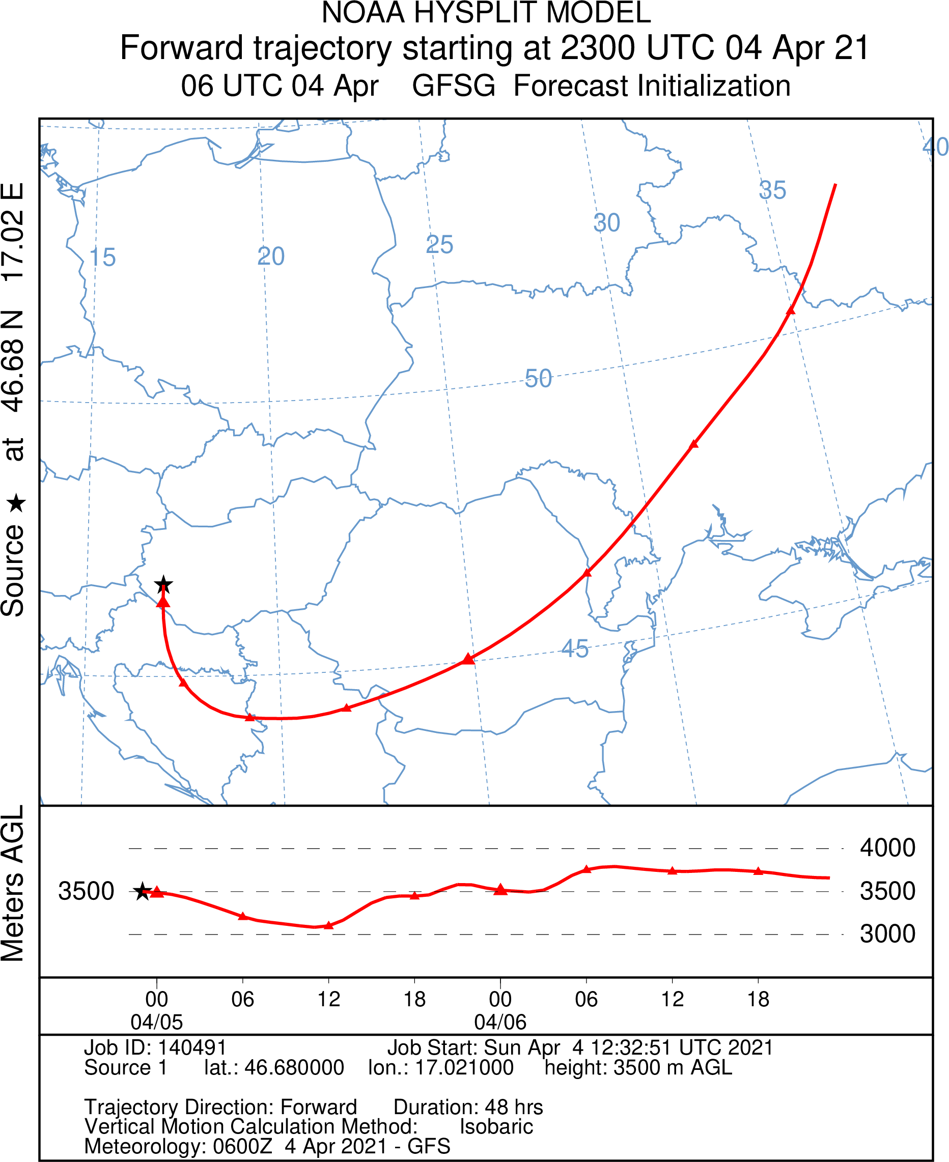
B15
New altitude at 2300 UTC 46.6800 N / 17.0210 E
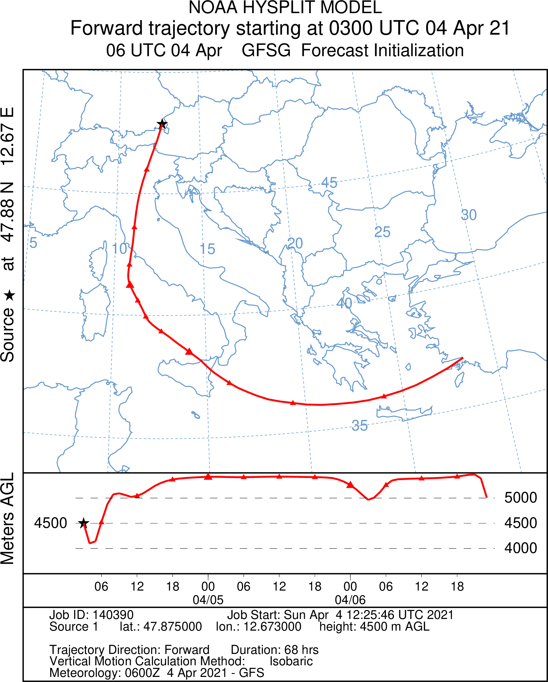
B25
New altitude at 0300 UTC 47.8750 N / 12.6730 E
Nancy
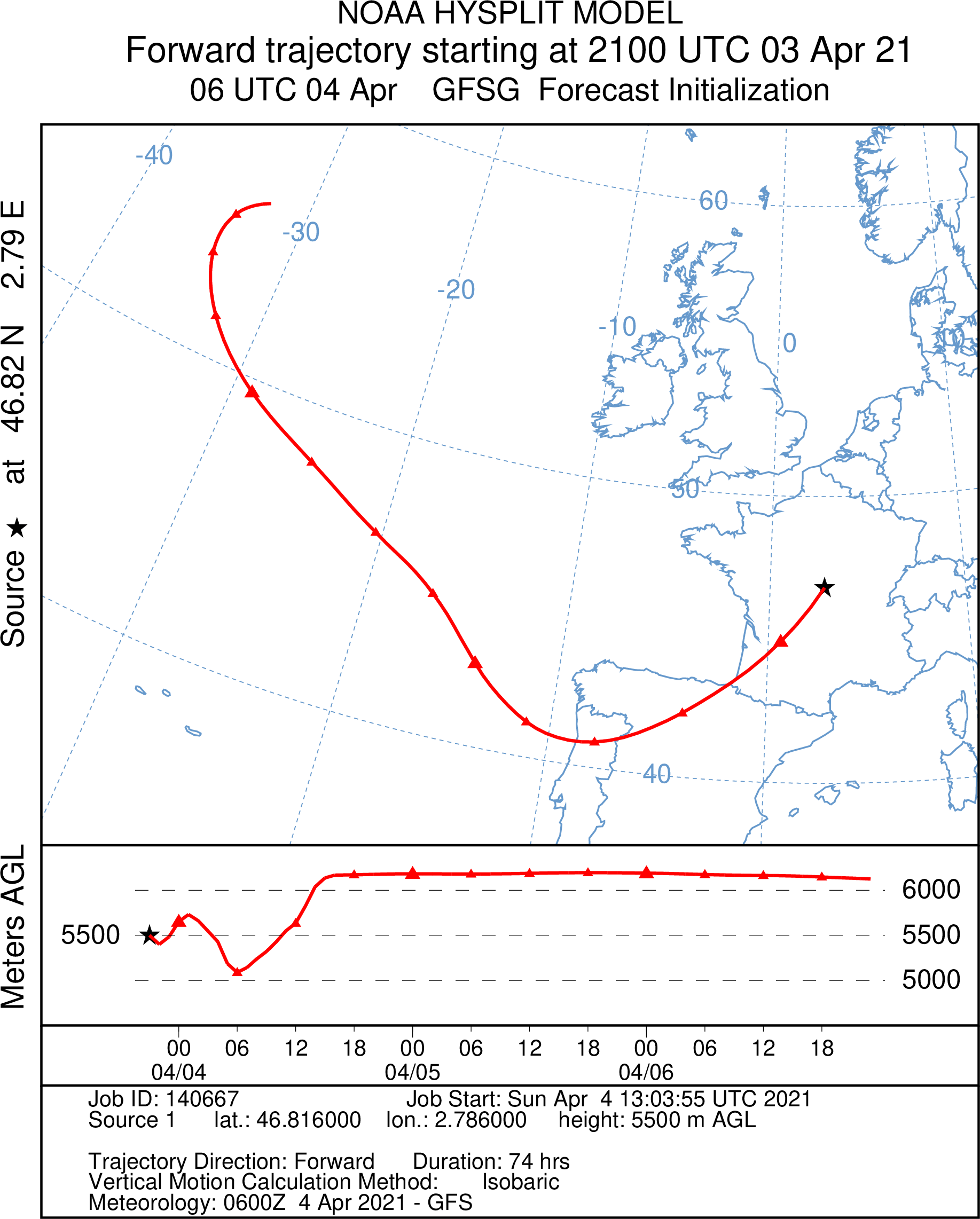
N05
New altitude at 2021/03/04 2100 UTC 46.8160 N / 2.7860 E.
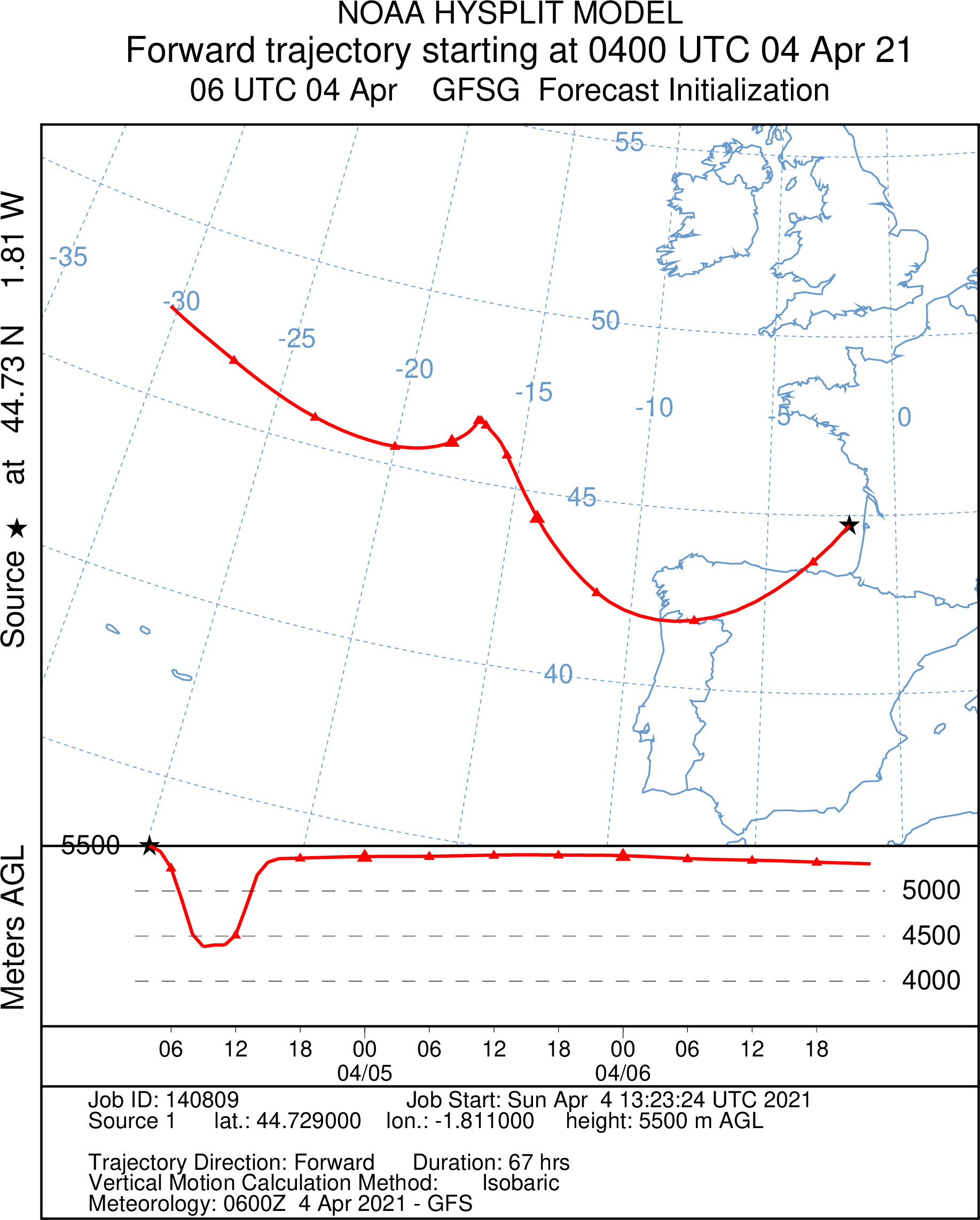
N15
New altitude 0400 UTC 44.7290 N / 1.8110 W
N25
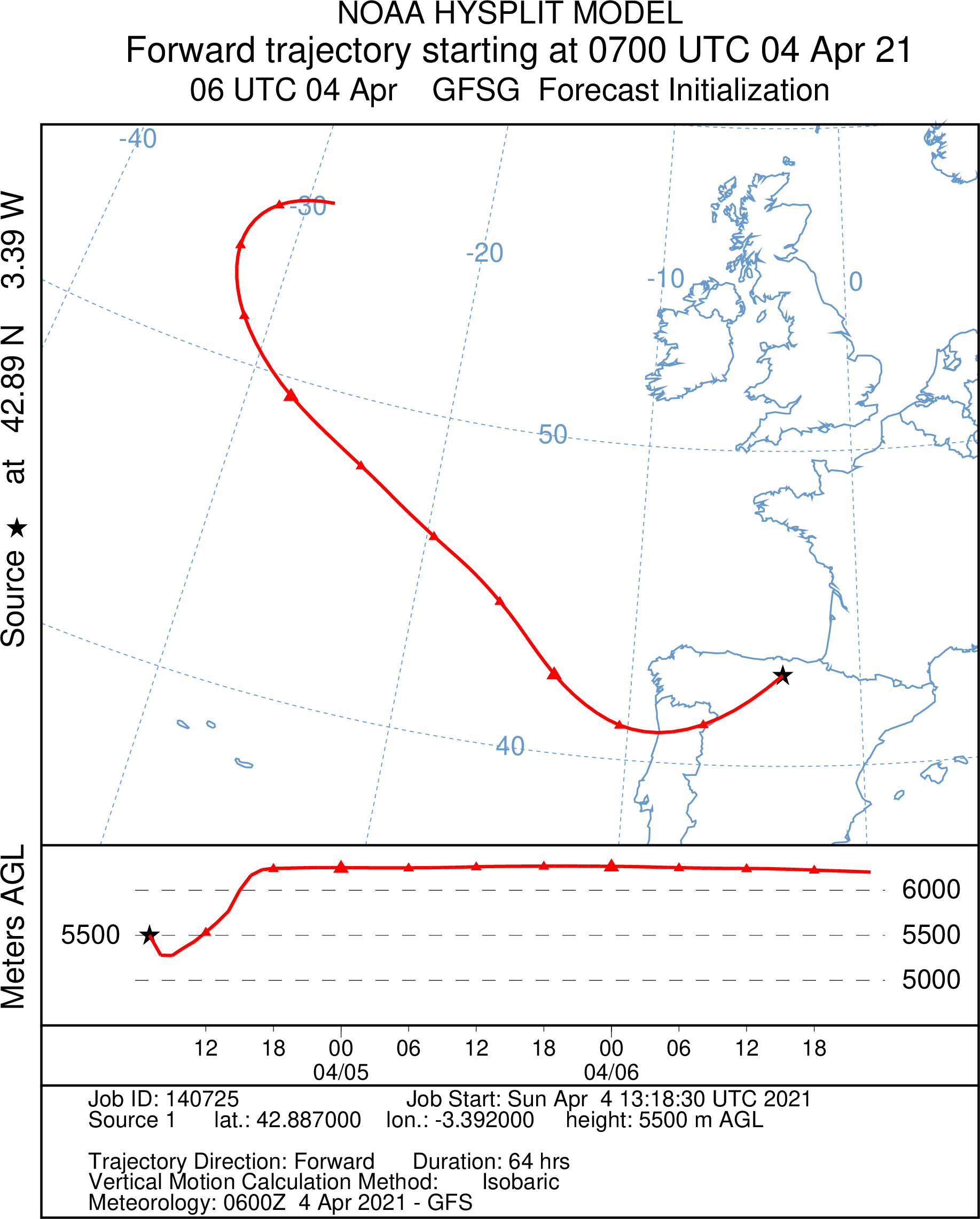
New altitude at 0700 UTC 42.8870 N / 3.3920 W
Wrocław
W05
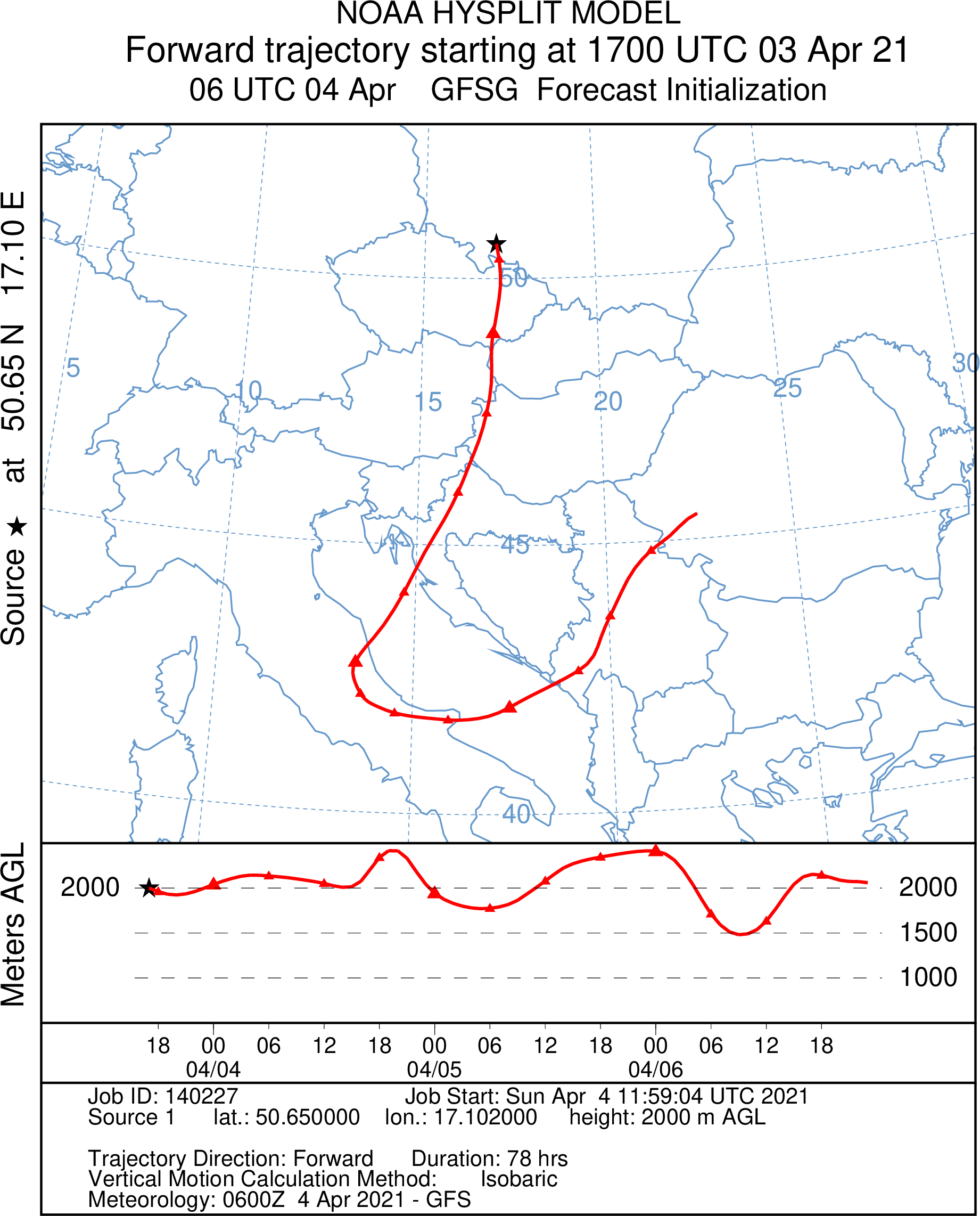
New altitude at 2021/04/03 1700 UTC 50.6500 N / 17.1020 E
W15
New altitude at 1700UTC 45.4130 N / 16.8160 E

W25
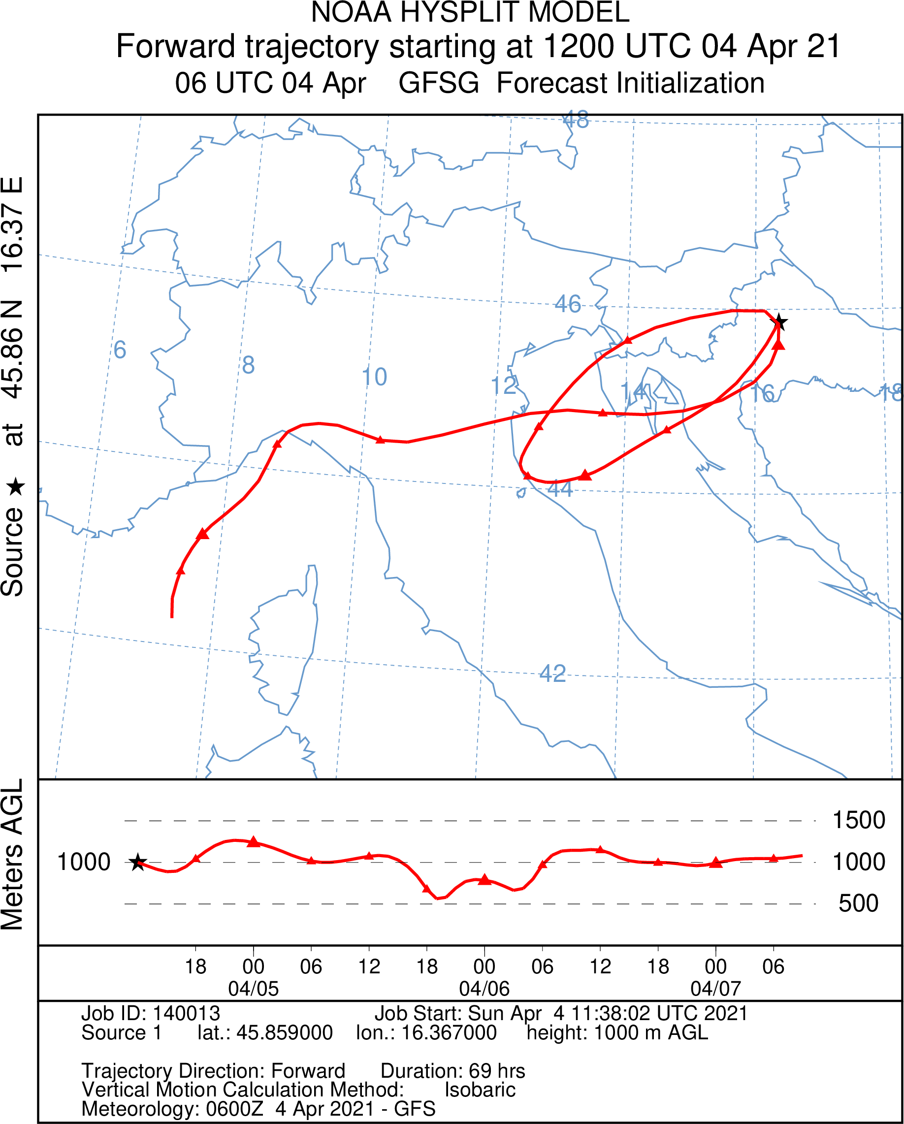
New altitude at 1200UTC and 45.8590 N / 163670 E
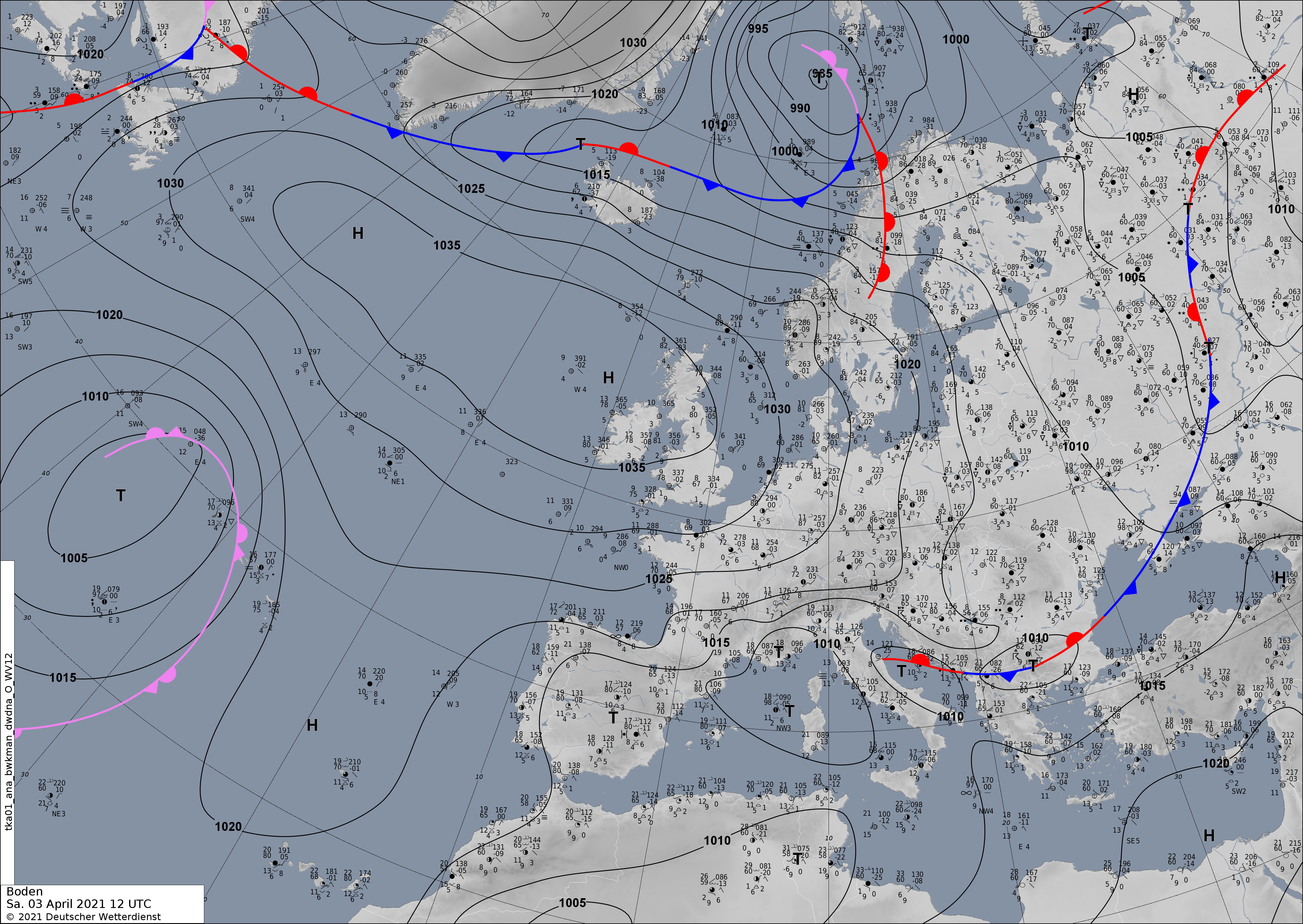
2021/04/03 0200UTC
Last Analyse Chart
Ground
500hPa
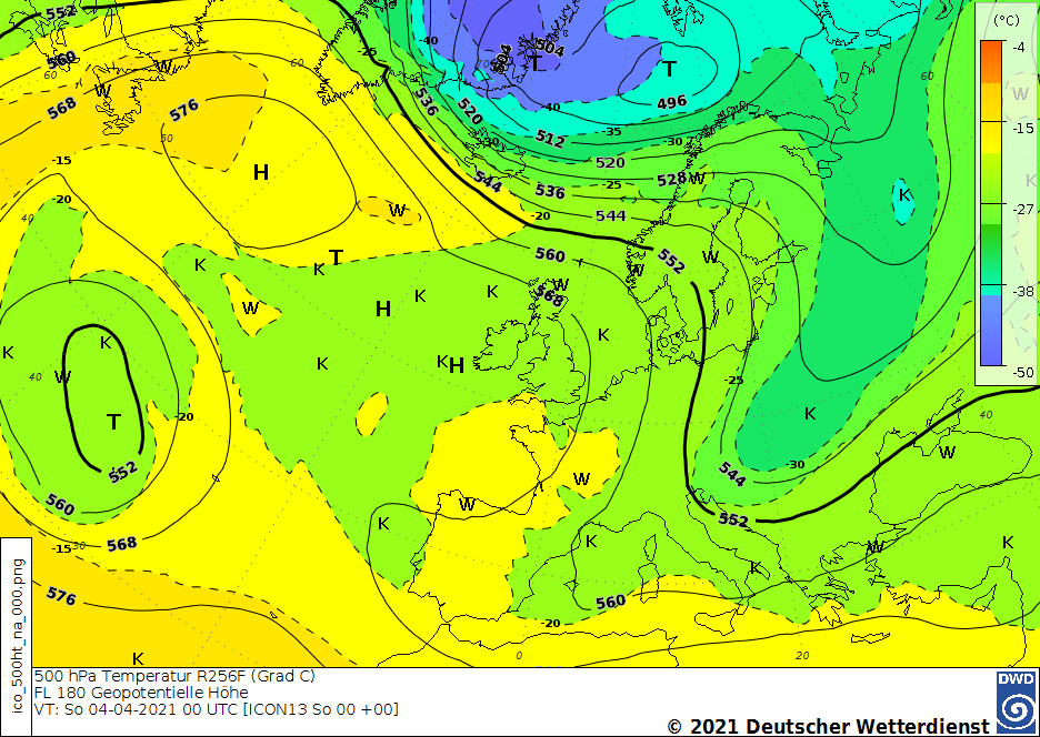
2021/04/03 1500UTC
METAR
- EDDP Leipzig/Halle METAR EDDP 031450Z 35018G30KT CAVOK 10/M04 Q1022 TEMPO 35020G30KT=
- Nancy/Essey 031400Z AUTO 05013G19KT 19KM FEW052 11/M01 Q1024=
- EPWR Wrocław METAR EPWR 031430Z 34010KT 310V020 9999 FEW016CB SCT021 06/01 Q1018 =
Windy situation. For a virtual departure okay, but in reality to much wind for the balloons. Maybe possible in Wrocław.
Last Analyse Chart
Ground
500hPa
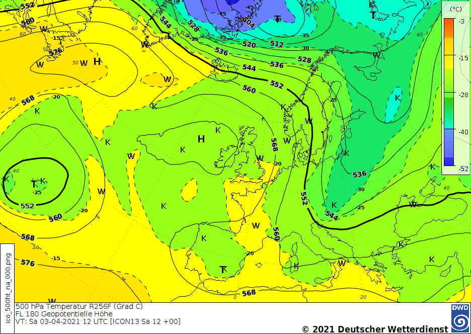
2021/04/03 Launch at 1500
The results of the calculation of the trajectories.
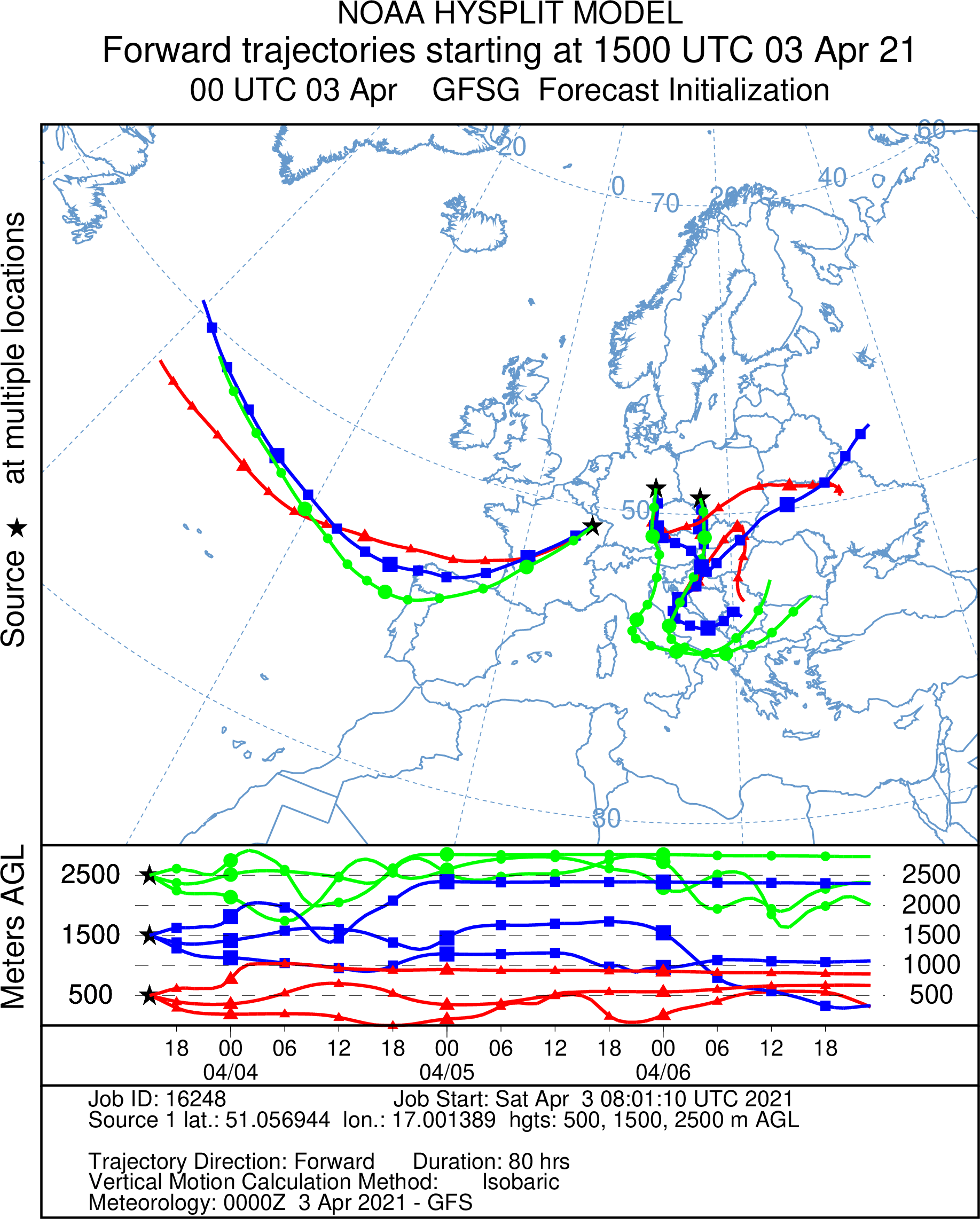
2021/04/02 First step
As a first step, we would now like to do a demonstration flight from three starting locations.